Kingfisher Airport
Kingfisher Airport | |||||||||||
|---|---|---|---|---|---|---|---|---|---|---|---|
| Summary | |||||||||||
| Airport type | Public | ||||||||||
| Location | Kingfisher, Oklahoma | ||||||||||
| Elevation AMSL | 1,072 ft / 327 m | ||||||||||
| Coordinates | 35°52′37″N 97°57′11″W / 35.87695°N 97.95294°W | ||||||||||
| Map | |||||||||||
| Runways | |||||||||||
| |||||||||||
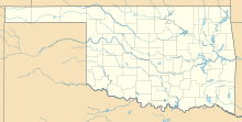
Kingfisher Airport (FAA LID: F92) is a public use airport located 1 mile northwest of Kingfisher, Oklahoma, in Kingfisher County. The airport is publicly owned by the city of Kingfisher.[1][2]
Overview[edit]
Kingfisher Airport has one runway, marked 18/36. The runway is 2,800 feet long and 60 feet wide with a concrete surface. 100LL self-service is available on site.[1] For the 12 months ending 9 February 2018, 4,000 general-aviation and 10 military operations were recorded.[1]
See also[edit]
References[edit]
- ^ a b c Federal Aviation Administration. (Form 5010) Archived 2019-01-31 at the Wayback Machine Effective 31 January 2019
- ^ "FAA Information about Kingfisher Airport (F92)". www.airport-data.com. Retrieved 2023-04-16.
External links[edit]


